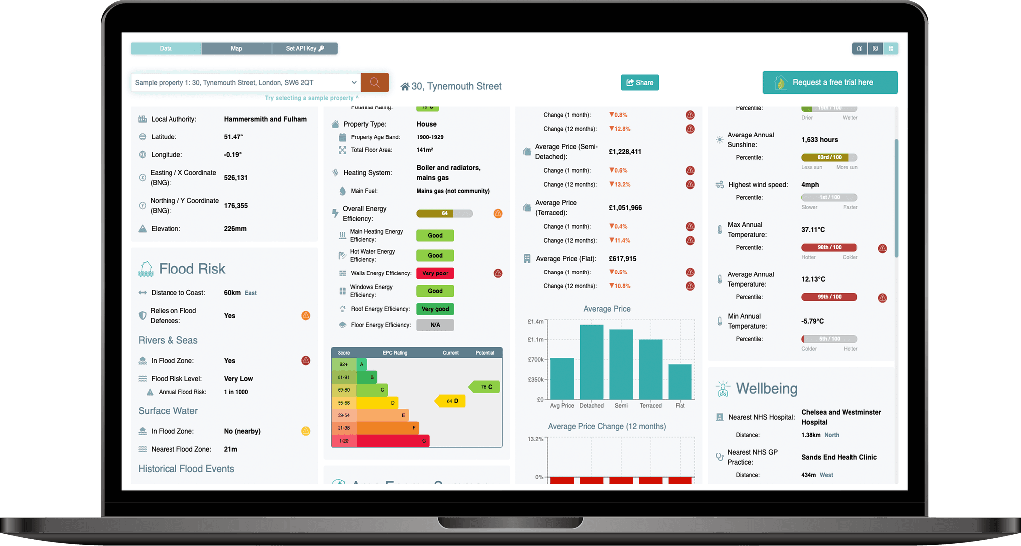
API Dashboard product shot

API

Access thousands of data points with four lines of code

Access the most comprehensive and up-to-date catalogue of property-specific data relating to climate risks, energy efficiency and wellbeing impacts.

Seamlessly integrate within existing products and services to improve decision-making, boost engagement and reduce risks.

The PropEco API is a full REST-based API service for querying UK-wide property and location data, and for interacting with our proprietary computational models. This focuses on three core topics: energy efficiency, climate risks and sustainability & wellbeing.

The API provides an additional layer of geospatial and / or statistical analysis to help users make the most of the underlying data, which can be accessed using just a coordinate or unique property reference number (UPRN).

The following endpoints are available:

Properties

The properties API can be used to retrieve a wide range of information tied to a specific UK property, including:

Air quality

Concentrations of common pollutants including particulate matter and sulphur dioxide.

Airports

Distance to, location and details of the closest airport(s).

Climate change projections

Projected changes to temperature and weather patterns under multiple climate change scenarios.

EV charge points

Electric vehicle charging infrastructure located within a 1km radius.

Flood risk

Risk of flooding from rivers and seas.

Grants

Local and national support schemes for green home upgrades.

Greenspace

Proximity of parks, nature reserves and other greenspaces.

Healthcare facilities

Distance to and location of the closest hospitals, GP practices, dentists and defibrillators.

House prices

Average prices and price trends of residential properties.

Landslides

Proximity and location of recorded landslides within a 1km radius.

Location details

The names and identifiers of administrative boundaries and regions within which the property lies.

Planning restrictions

Planning restrictions including conservation areas, listed buildings and World Heritage Sites.

Radon exposure

An indicative assessment of radon exposure.

Social factors

Including Index of Multiple Deprivation and fuel poverty.

Weather

Historical weather trends and rankings covering temperature, rainfall, wind speed and sunshine.

You can find out more about the data that the API provides here

Location

The location API can be used to retrieve a wide range of information tied to a specific geographical location in the UK, identified by either latitude & longitude or X & Y grid position.

The response is similar to that of the properties API detailed above - the key difference is that data relating to energy performance certificates is omitted.

You can find out more about the data that the API provides here

EPCs

The EPCs API can be used to retrieve a variety of information about the Energy Performance Certificate (EPC) of a domestic property in England, Scotland or Wales. This includes:

Raw EPCs

These are unmodified EPCs taken directly from government sources. Note that raw EPCs often contain inconsistencies and unsanitised data points, so we recommend working with our enhanced EPCs instead.

Enhanced EPCs

These are modified EPCs that have been taken through a standardisation process to sanitise their contents and remove inconsistencies (find out more here). We recommend working with these rather than raw EPCs.

EPC Estimates

For properties that have no available EPC, the API provides an estimated assessment (where possible) based on the attributes of nearby properties.

EPC Statistics

A statistical analysis of the energy efficiency of the wider housing stock that is designed to help you assess the relative performance of the property you are searching for.

You can find out more about the data that the API provides here

Energy Model

The PropEco energy model leverages the power of dynamic modelling to provide highly accurate projections of the energy use and carbon footprint of residential properties. Projections are provided as aggregate figures, and also broken-down by month and use (space heating, water heating and lighting).

Space Heating

Water Heating

Lighting

Energy Costs

Carbon Footprint

The model addresses many of the limitations of commonly used methodologies such as SAP (which underpins EPC assessments) and enables you to factor-in a wide range of considerations including property attributes (size, type, age, level of insulation etc), local climatic conditions, occupancy levels and usage patterns.

You can find out more about the data that the API provides here

Flood risk

The flood risk API provides an in-depth assessment of the flood risk from rivers, seas and surface water at a property or location. It also provides several complimentary data points including elevation, distance to coast, evidence of historical flooding and reliance on flood defences.

Elevation

Height above sea level of the property or location.

Flood defences

A check to determine whether the property or location benefits from flood defences.

Flood risk

Risk of flooding from rivers, seas and surface water.

Historical Flooding

A check for signs of historical flooding at the property or location.

You can find out more about the data that the API provides here

We will be adding new endpoints in the coming months, including a dedicated overheating API. Please contact us at info@propeco.io for more information or to request an update.

Pricing

Subscription plans are designed to be accessible and flexible.

Exploration

£29+ VAT /month
  • Property-level assessments
  • Physical & transition climate risks
  • Wellbeing impacts
  • Up to 250 calls per month

Start-up

£69+ VAT /month
  • Property-level assessments
  • Physical & transition climate risks
  • Wellbeing impacts
  • Up to 750 calls per month

Scale-up

£149+ VAT /month
  • Property-level assessments
  • Physical & transition climate risks
  • Wellbeing impacts
  • Up to 3,000 calls per month

Contact us for information on enterprise-level pricing.

API subscriptions can also be used to assess properties using the PropEco Data Explorer, while some UK-wide thematic subsets are available to licence.

Maps

Easily integrate detailed, up-to-date map layers into existing websites or applications.

Data explorer map example 1
Data explorer map example 2
Data explorer map example 3
Data explorer map example 1
Data explorer map example 2
Data explorer map example 3

Data Explorer

Instantly access property-specific data, maps and tools through the PropEco Data Explorer.

data explorer mock up

Submit your details below to set-up a free trial

Which endpoints would you like to test?

You can also contact us at info@propeco.io or connect with us on LinkedIn here.