
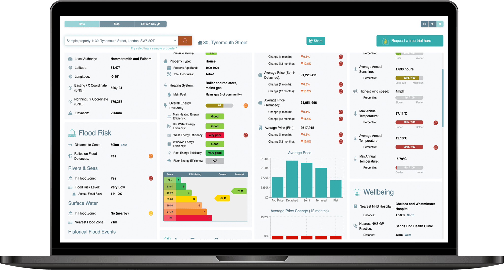
The PropEco Flood Risk API provides data & analysis relating to the flood risk at UK properties and locations. Each assessment includes:
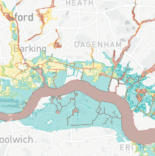
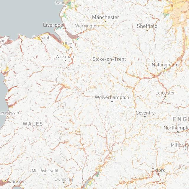
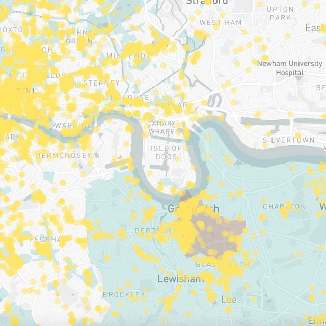
 Flood risk
Risk of flooding from rivers, seas and surface water.
 Flood risk with climate change
Risk of flooding across future climate change scenarios.
 Elevation
Height above sea level of the property or location.
 Historical flooding
Details of recorded flood events.
 Flood defences
A check to determine whether the property or location benefits from flood defences.

Pricing
Subscription plans are designed to be accessible and flexible.
Exploration
£29/mo
- Property-level assessments
- Access to all API endpoints
- Up to 250 calls per month*
Start-up
£69/mo
- Property-level assessments
- Access to all API endpoints
- Up to 750 calls per month*
Scale-up
£149/mo
- Property-level assessments
- Access to all API endpoints
- Up to 3,000 calls per month*
Enterprise
£POA/mo
- Property-level assessments
- Access to all API endpoints
- Dedicated & customised endpoint
*Usage is based on a credit system in which the number of credits consumed per API call varies by endpoint. Figures shown are for level one endpoints such as Property Data, EPCs or Flood Risk.
Contact us for information on enterprise-level pricing.
All API subscriptions can be used to assess properties and locations using the PropEco Data Explorer and any API endpoint.

Need more information? Submit any questions or requests via the form below.
You can also contact us at info@propeco.io or connect with us on LinkedIn here.